We offer various types of aerial photogrammetry. Uses include: construction progress, mapping and stockpile calculations.
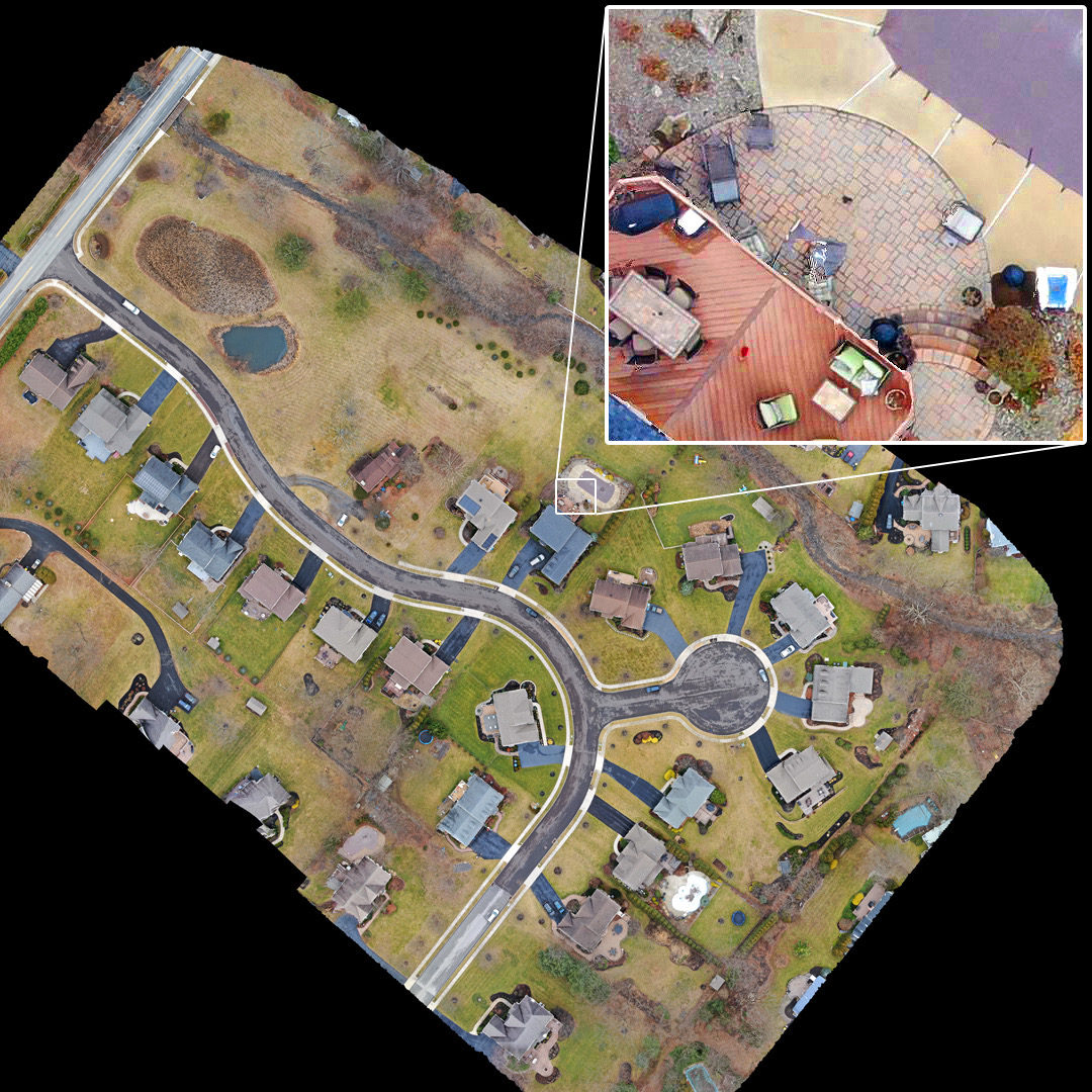
Aerial Mapping
We can create high resolution maps of large areas with resolutions up to 25 pixels per square inch. This is accomplished by combining hundreds of aerial images into a single, very high resolution image.
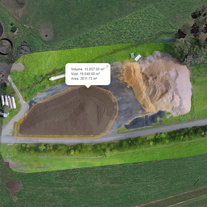
Stockpile Volume Calculations
Using advance image processing we first create an accurate 3D model of the area, then volumetric measurements are calculated.